

Experts predict ‘somewhat below-average’ storm season
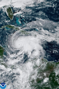
One of the nation’s top forecasters when it comes to the Atlantic hurricane season released its first predictions of the 2026 season on April 9, with some encouraging news for Southwest Floridians.
Colorado State University (CSU) hurricane researchers have predicted a “somewhat below-average” in its initial 2026 forecast.
Citing a “robust” El Niño as a primary factor, the CSU team is predicting 13 named storms, of which they anticipate six to become hurricanes, and two to become major hurricanes (Category 3 or higher).
CSU officials said the numbers are below the long-term season average of 14, seven and three, respectively. Hurricane season runs from June 1 to Nov. 30.
“So far, the 2026 hurricane season is exhibiting characteristics similar to the 2006, 2009, 2015 and 2023 seasons,” Phil Klotzbach, a senior research scientist in CSU’s Department of Atmospheric Science and lead author of the report, said in a release.
“Our analog seasons ranged from well below-average Atlantic hurricane activity to somewhat above average. While the average of our analog seasons is somewhat below normal, the large spread in observed activity in our analog years highlights the high levels of uncertainty that typically are associated with our early April outlook,” he continued.
As always, hurricane activity comes down to the presence of El Niño, which is a natural climate pattern characterized by the warming of ocean surface temperatures in the central and eastern tropical Pacific Ocean.
CSU officials said the tropical Pacific currently has weak La Niña conditions.
“La Niña is effectively the opposite of El Niño and is characterized by cooler than normal waters in the eastern and central tropical Pacific,” the report stated. “However, these conditions are forecast to rapidly transition to El Niño in the next few months. While the intensity of the likely El Niño is uncertain, the CSU team anticipates that a moderate to strong El Niño is most likely by the peak of the Atlantic hurricane season from August-October.”
CSU officials said that currently, waters in the western tropical Atlantic are warmer than normal, while waters in the eastern tropical and subtropical Atlantic are slightly cooler than normal.
“Overall, currently observed sea surface temperatures across the tropical and subtropical Atlantic present mixed signals for the upcoming hurricane season,” the report stated. “Warmer waters in the western Atlantic would favor above-normal activity, while cooler waters in the eastern tropical and subtropical Atlantic would favor below-normal activity. A warm Atlantic favors an above-average season, since a hurricane’s fuel source is warm ocean water. Additionally, a warm Atlantic leads to lower atmospheric pressure and a more unstable atmosphere. Both conditions favor hurricane formation.”
In its hurricane landfalling probability for 2025, researchers put the likelihood of a major hurricane for the Gulf Coast from the Florida panhandle westward to Brownsville, Texas, at 20% (average from 1880 to 2020 is 27%).
As always, the researchers cautioned coastal residents to take proper precautions.
“It takes only one storm near you to make this an active season for you,” Michael Bell in the release.
It is the 43rd year that CSU has issued an Atlantic forecast. The CSU team will issue updates to the forecast on June 10, July 8 and Aug. 5.
To reach CJ HADDAD / cjhaddad@breezenewspapers.com, please email